Podolia is a historical region with a rich past, diverse landscape, and remarkable tourist potential.
The name Podolia comes from the phrase “under the forest” or “at the foot,” referring to its location at the base of the forests and hills of Volhynia. From the 11th century, the region belonged to Kievan Rus, and later to the Halych-Volhynian Principality.
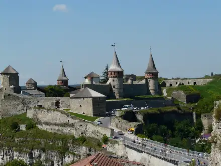
In the 14th century, Podolia was incorporated into the Crown of the Kingdom of Poland. Between the 15th and 18th centuries, it was divided into the Podolian Voivodeship (with its capital in Kamianets-Podilskyi) and the Bracław Voivodeship (part of so-called Eastern Podolia).
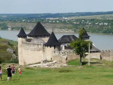
The region was frequently devastated by Tatar and Ottoman raids, serving as a frontier between Christianity and Islam.
Kamianets-Podilskyi was occupied by the Ottoman Empire from 1672 to 1699 as the so-called Eyalet of Kamianets. After the Second Partition of Poland, most of Podolia became part of the Russian Empire, while a smaller portion (so-called Western Podolia) went to Austria.
Podolia stretches between the rivers Zbruch, Dniester, Southern Bug, and Styr. The terrain is upland and undulating, with numerous ravines, karst valleys, and rock formations (e.g., in Bakota). The main rivers are the Dniester (an important historical and settlement axis), Zbruch, and Smotrych.